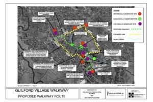
In September 2006 the GPA, in conjunction with the Town of Guilford, completed a Feasibility Study for phase 1 of The Guilford Village Walkways Project. This phase involves a walkway that would extend from the Guilford Green to the Historic Train Station buildings. The funding for this study was provided from a Certified Local Government grant from the Historic Preservation and Museum Division of the Connecticut Commission on Culture and Tourism, with matching funds from the GPA. The GPA and the Town also contributed “in kind” services. The grant was used to retain Elana Pascarella with Landscape Elements LLC of Pawcatuck, Connecticut, and Linda Steere with Applied Bio-Systems of West Kingston, Rhode Island to conduct a Feasibility Study and produce documents about their study.
The proposed Guilford Village Walkway would connect the historic Green at the north end to the harborside and waterfront at the south end. In between the traveler would learn about local history in each period of Guilford ‘s development: the early Colonial settlement, the era of coastal trading and local agriculture, the advent of the railroad and small industries, and the development of highways and the post war garden suburb. Along the way, the walkway would pass by the Whitfield Street historic neighborhoods, one of the most outstanding districts of mid to late 19th century architecture in the state. It would pass also the Henry Whitfield Museum , the earliest stone dwelling in Connecticut , as well as the very rare surviving railroad buildings at the Guilford depot. The terminus would be the harborside, where shipping and trading played a key role in local history since the early 1600s.
The Guilford Village Center Committee of the Guilford Preservation Alliance working in partnership with the Town of Guilford, local residents and property owners, and other stakeholders in the area, proposes working to create an “in-town” heritage recreational and scenic foot path that would link up key historical structures and landscapes in the village center through a linear trail at the same time providing state of the art interpretive markers and displays that would describe the numerous sites and vistas found along the way.
Through the design, layout, and construction of the trail, it is hoped to create a dynamic pedestrian experience, attracting not just local residents but the many heritage oriented tourists who come to the shoreline each year who although they might visit and shop on the picturesque Guilford green, miss the other important historical assets and landscapes in the immediate vicinity.
To view the proposed walkway map in large scale click here or on the image. To view a smaller scale version, click here.
The complete study document may be viewed here.


